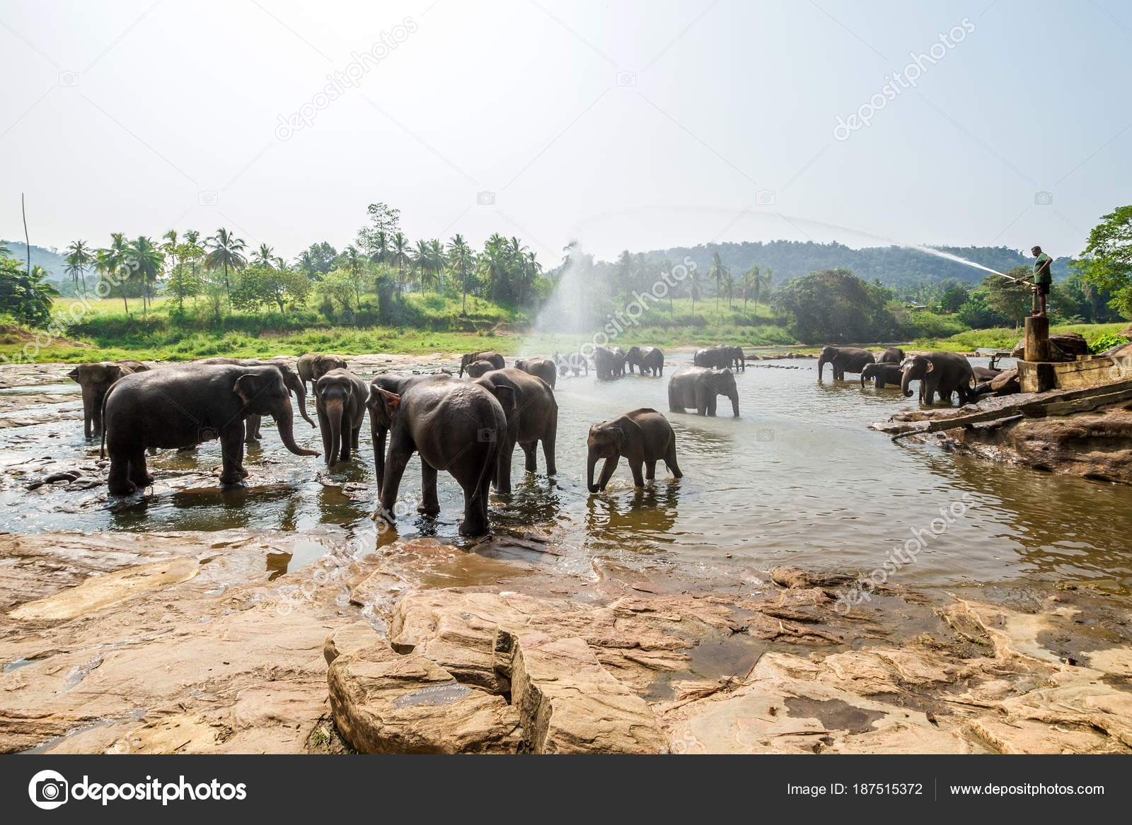
Herd of elephants at Pinnawala
| |
| Date opened | 1975 |
|---|---|
| Location | Pinnawala, Kegalle, Sabaragamuwa, Sri Lanka |
| Coordinates | 7°18′2″N 80°23′18″ECoordinates: 7°18′2″N 80°23′18″E |
| Land area | 25 acres (10 ha) |
| No. of animals | 88 (2011) |
| No. of species | 1 |

Pinnawala Elephant Orphanage is an orphanage, nursery and captive breeding ground for wild Asian elephants located at Pinnawala village, 13 km (8.1 mi) northeast of Kegalle town in Sabaragamuwa Province of Sri Lanka. Pinnawala has the largest herd of captive elephants in the world. In 2011, there were 96 elephants, including 43 males and 68 females from 3 generations, living in Pinnawala.[1]
The orphanage was founded to care and protect the many orphaned unweaned wild elephants found wandering in and near the forests of Sri Lanka. It was established in 1975 by the Sri Lanka Department of Wildlife Conservation (DWC).[2]
History[edit]

The Pinnawala Elephant Orphanage was established by the Sri Lankan Department of Wildlife Conservation in 1975 for feeding and providing care and sanctuary to orphaned baby elephants that were found in the wild. The orphanage was located at the Wilpattu National Park, then shifted to the tourist complex at Bentota and then to the Dehiwala Zoo. From the Zoo it was shifted to Pinnawala village on a 25-acre (10 ha) coconut plantation adjacent to the Maha Oya River.
The primary residential care area is on the east side of Highway B199, Rambukkana Road. The main site also has some restaurants and refreshment stands, and management buildings including sleeping sheds and veterinary facilities. The elephant bathing and viewing area along the Oya River is directly opposite on the west side of the highway.[3][4]
At the time it was settled, the orphanage had five baby elephants which formed its nucleus. The addition of orphans continued till 1995 when the Elephant Transit Home (ETH) adjoining Udawalawe National Park was created by the DWC. Since then, orphaned babies have been taken to the ETH and addition to the Pinnawala herd has been mostly through births occurring there.[1]
It was planned for the facility to attract local and foreign visitors, the income from which would help to maintain the orphanage. The Pinnawala Orphanage has since become a tourist attraction. In 1978, the orphanage was taken over by the Department of National Zoological Gardens Sri Lanka. In 1982 an elephant breeding program was launched. As of 2012, there were 78 elephants living here.
Visitors to the park can view the care and daily routine of the elephants, such as bottle feeding of elephant calves, feeding of all other elephants, and bathing in the Ma Oya (River).
Elephant care[edit]
The orphanage was established to feed, nurse and house young elephants found abandoned by their mothers. Young elephants sometimes fall into pits and ravines in their quest for water during drought period. Other orphans have been displaced from their wild habitat by development projects or have been found abandoned before weaning, diseased or wounded.[2]
There are 48 mahouts (handlers) who take care of the elephants. The female and young elephants in Pinnawala range freely as a herd during the day in an area of a few acres. They are herded about .5 km (0.31 mi) twice a day to drink and be bathed in the river. At night, the females are individually chained in stalls. Adult males do some light work such as transporting feed. They are chained and managed individually. Calves born in Pinnawala are not bottle fed, but a few from ETH are kept at Pinnawala and bottle fed as a tourist attraction.[1]
The elephants are fed in their stalls. There is very little food they can gather from the premises of the orphanage except some grass. Large quantities of jackfruit, coconut, kitul (sugar palm), tamarind and grass, brought in daily, form the bulk of the elephants food.[5] Each adult animal is given around 250 kilograms (550 lb) of this green matter per day and around 2 kg (4.4 lb) from a food bag containing rice bran and maize.[2]


Elephant breeding[edit]
This elephant orphanage conducts captive breeding of some elephants in its care. The natural environment and healthy care and feeding at Pinnawala made the elephant breeding program a success. The first birth at Pinnawala was in 1984, Sukumalee, a female was born to Vijaya and Kumar who were aged 21 and 20 years respectively at the time. The males Vijaya and Neela and females Kumari, Anusha, Mathalie and Komali have since then parented several baby elephants. More than twenty-three elephants were born from 1984 to 1991. In 1998 there were fourteen births at Pinnawala, eight males and six females, with one second generation birth in early 1998. Since then till 2nd of July 2015 , 70 more were born at Pinnawala.[2][6]
12 elephants were released to temples and private owners since June, 2011. Shama (female, aged 24), Lasanda (female, aged 18), Mihindu (male, aged 13), Haritha (male, aged 10 years), Atlas (male, aged seven), Charaka (male, aged five), Asela (male aged 8), Tharindu (male aged 5), Wasana (male aged 11), Arjuna (male aged 14) and Vishwa (male aged 5) were among those.[6]
Animal welfare[edit]

Most of the elephants at Pinnawala are healthy and once attaining adulthood, will be retained within the facility mostly since they have become dependent on supplied food. A few disabled elephants are given residential care. One tusker, Raja is blind, and one female, named Sama, lost her front right leg to a land mine.
Pinnawala Elephant Orphanage was the subject of a 2010 report by the Born Free Foundation which called into question animal welfare at the orphanage.[3]
Quality of care of elephants who are donated from Pinnawala has been a big public issue. In 2012 The Sri Lanka Environment Trust spoke out against authorities who continue to 'donate' tamed elephants to people who had 'poor' past records of taking care of animals. "There are enough cases to show that the authorities are releasing elephants from Pinnawala to the same group of people who don't take care of the animals." Despite these accusations it is proven that the surveillance is done by the fact that four of such donated elephants by presidential decree being returned to the elephant by a court order.[6]


Hints & tips
- please visit official website for more information like Feeding time and bath times
- http://nationalzoo.gov.lk/elephantorphanage/

Disclaimer
The above comments are based on my personal travel
experiences to this particular location in summer months. Your experience may
vary due to weather and traffic.
My trips were not sponsored by any of the authorities and my
comments are not biased or representing any views of governing bodies.
History and information extracted from Wikipedia and photos
were selected from Google images and all rights reserved with original owners.
This is only for an informational purpose. Not for commercial
use.
Note.
Hope you will enjoy your visit. Please make your comments,
suggestions & travel questions. I am happy to provide information on my
earliest convenience & update the post accordingly.


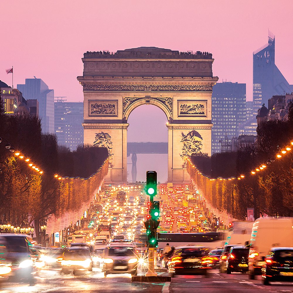
:max_bytes(150000):strip_icc()/GettyImages-470636431-56a404c35f9b58b7d0d4f3db.jpg)


_par_Rude,_Arc_de_Triomphe_Etoile_Paris.jpg)


,_arc_de_Triomphe,_soldat_d%27un_monument_aux_morts_%C3%A0_l%27int%C3%A9rieur_5.jpg)